
Our Solutions - Agricultural AI and Drone Sensing Technology
Solutions
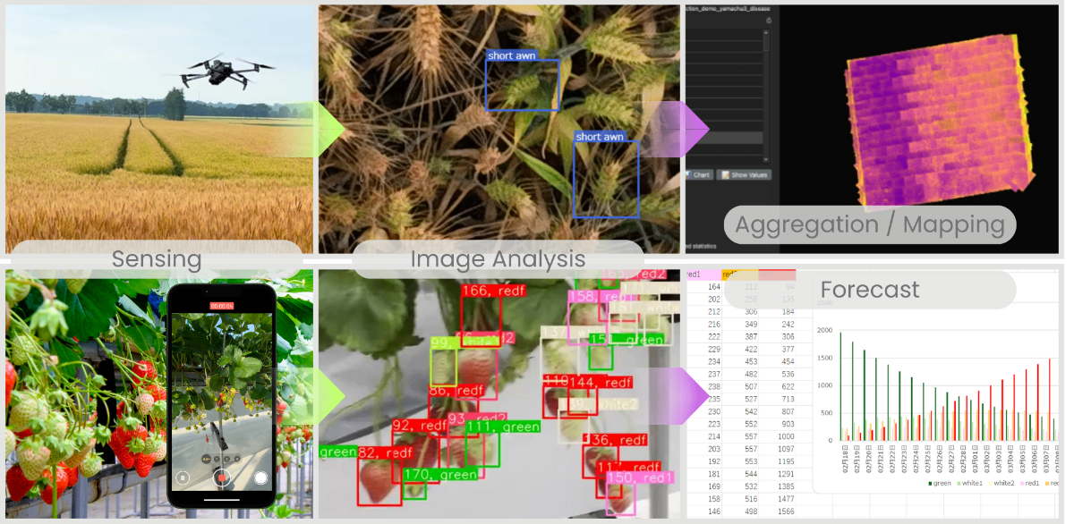
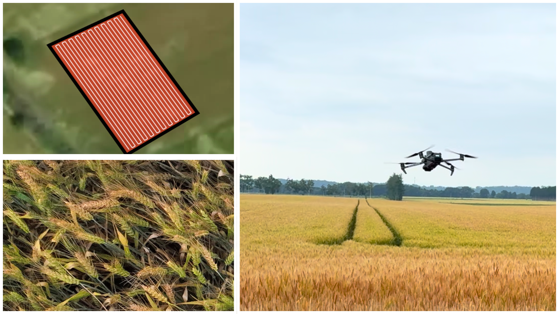
Our proprietary software enables autonomous drone flight and imaging from as low as 1 meter.
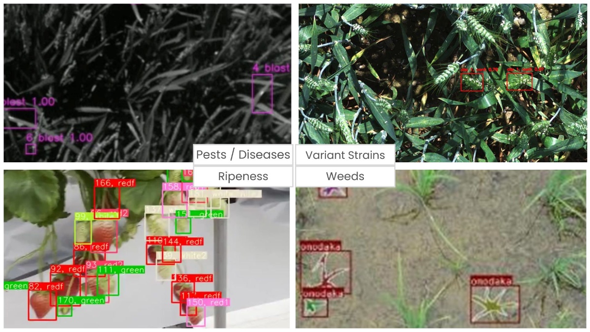
Through close-range sensing and AI-based crop image analysis, we deliver 1–2 cm–scale detection of pests and diseases, as well as detailed analysis across crop growth stages.
Crop Image Analysis AI
- Object detection and segmentation models for crops and agricultural pests
- High-precision and high-speed optimization of AI models tailored to specific applications
- Custom AI development to transform user expertise and identification know-how into AI
Solutions & Services
Prototype development & feasibility studiesFrom USD 5,500
Custom AI developmentQuoted based on complexity
Close-Range Drone Sensing
- Comprehensive autonomous flight and imaging from ultra-low altitudes as low as 1 meter
- Compatible with your RTK-enabled drones (e.g., DJI Mavic 3 Enterprise RTK)
- Supports both still image and video capture
Solutions & Services
Pathfinder: Drone Flight-Path Generation App
From USD 1,600/yearDrone Sensing Service (On-site operation - Japan only)From USD 1,600/day
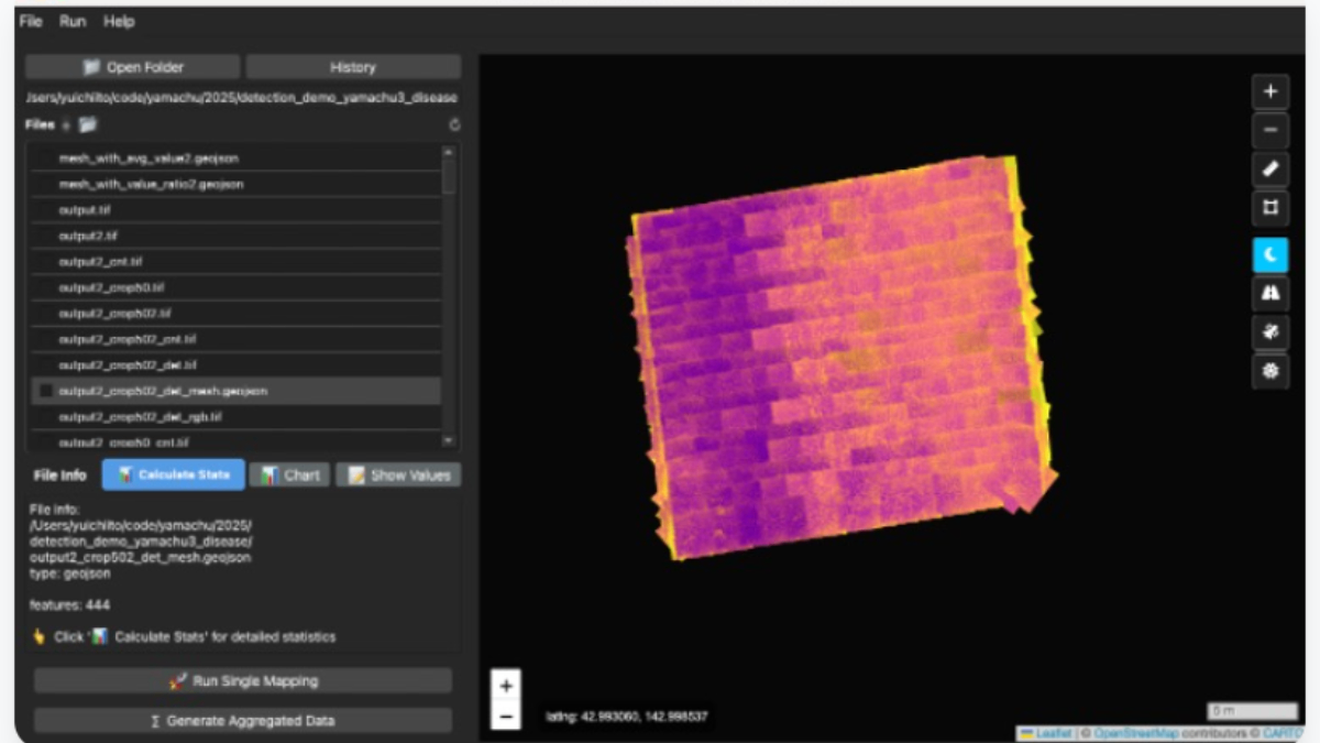
Detection Data Visualization & Yield Prediction
- Mapping and aggregating detected objects in geospatial context
- Predicting future observations based on detection volume and growth models
Solutions
SWALO Scanner
Integrated software platform for executing image analysis AI models, aggregating results, and mapping to geospatial context
¥400,000/year~
BerryCast (Strawberry Yield Prediction)
Capture strawberry cultivation fields with smartphone video, count fruits, and predict yields
¥4,000/month~